Milgun Project
Location
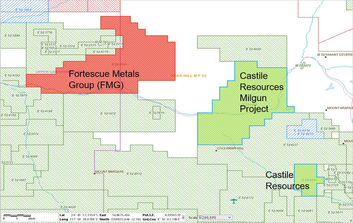
The Milgun Project is located approximately 150km north-northwest of Meekatharra in the Peak Hill Mineral Field of Western Australia.
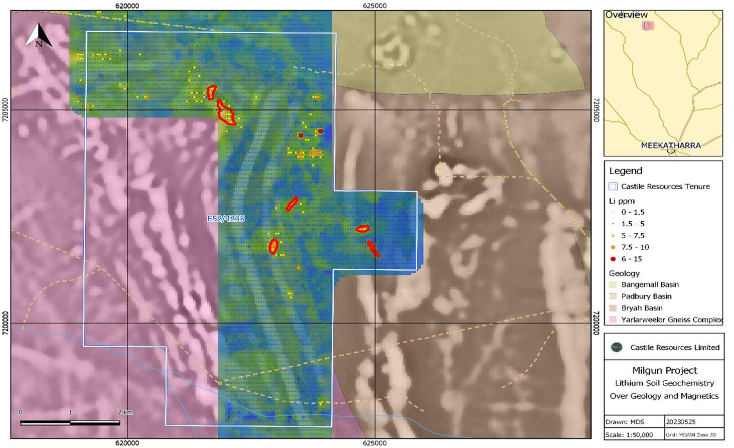
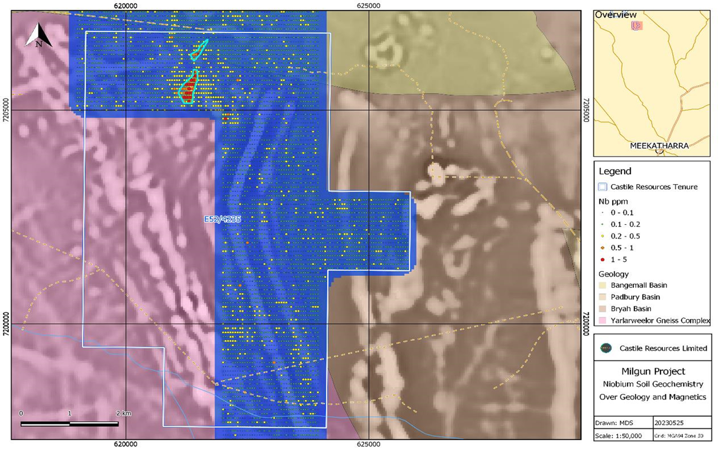
The Milgun Project comprises tenements E52/4206 and E52/4235. Field work aims to verify anomalous lithium and niobium soil geochemistry identified from historic exploration within E52/4235.
Opportunity
The Milgun Project tenements are considered prospective for critical minerals including Rare Earth Elements (“REE”) and Lithium-Caesium-Tantalum (LCT) pegmatites.
A review of publicly available data has shown anomalous critical minerals Lithium, Niobium and other Rare Earth Elements (REE’s) in soil sample assays at the Milgun Project. The historical data was collected in 2011 and 2012 by previous holders and included the results of over 9,000 soil samples. Previous exploration was primarily targeting copper and gold by way of soil geochemical surveys which were analysed for 53 different elements.
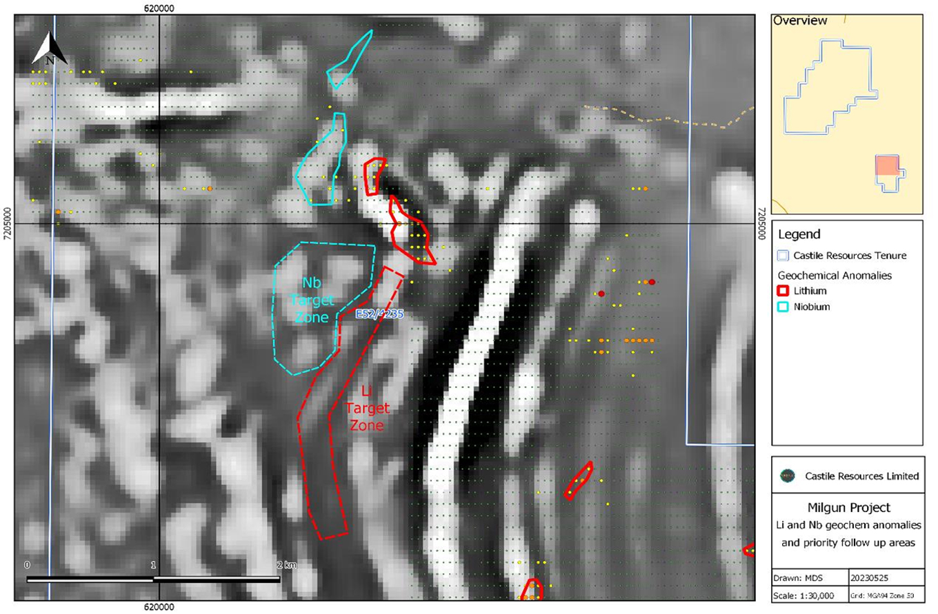
Castile’s review of the soil sampling assays has identified two particularly interesting anomalies:
- A coherent 900m x 300m Lithium-Caesium-Rubidium (Li-Cs-Rb) anomaly with associated low order Cerium–Tungsten (Ce-W) anomaly on the margin of the survey area that magnetics suggests is open to the south where there is no geochemical coverage.
- A coherent 800m x 175m Niobium-Yttrium-Thorium (Nb-Y-Th) anomaly with associated low order Beryllium-Tin (Be-Sn) anomaly that magnetics suggests continues to the south, where there is no geochemical coverage.
Castile is preparing for the field verification, mapping and rock chip sampling as soon as the contemplated Heritage Agreement has been actioned.
Exploration
Fieldwork in 2024 will consist of geological mapping and rock chip sampling over the anomalies and interpreted extensions, as well as reconnaissance through E52/4206.
Geology and Mineralisation
The basement geology consists of granite and gneisses of the Yarlarweelor Gneiss Complex (YGC) and portions of overlying Paleo and Neoproterozoic basin metasediments. The YGC is composed of intensely deformed and metamorphosed Archean Yilgarn and Palaeoproterozoic rocks with intrusions of granitic batholiths and sheets prior to and accompanying, exhumation during the Capricorn Orogen. High-grade metamorphism and crustal thickening c1812 Ma of late Archean and Palaeoproterozoic granitic rocks was accompanied by generation of REE enriched leucocratic I-Type granites and pegmatites from anataxis of the host rocks. Exhumation of the YGC was accompanied by further intrusion of sheets and dykes of differentiated I-Type granites and pegmatites.